Geolocate

Randolph topographic map

Click on the map to display elevation.

About this map

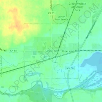
Name: Randolph topographic map, elevation, terrain.

Location: Randolph, Dakota County, Minnesota, United States (44.51867 -93.03003 44.53322 -93.00970)

Average elevation: 886 ft

Minimum elevation: 846 ft

Maximum elevation: 948 ft

Dakota County trails, hiking, mountain biking, running and outdoor activities

Other topographic maps

Click on a map to view its topography, its elevation and its terrain.

Pickerel Lake

United States > Minnesota > Dakota County > Lilydale

Average elevation: 827 ft

Hastings

United States > Minnesota > Dakota County

Average elevation: 797 ft

Hastings

United States > Minnesota > Dakota County

Average elevation: 797 ft

Coates

United States > Minnesota > Dakota County > Coates > Coates

Average elevation: 919 ft

Empire Lake

United States > Minnesota > Dakota County

Average elevation: 909 ft

Gear up for your next adventure:

🥤Water Filter Bottle - All‑in‑one filter bottle for safe hydration
🪑Portable Camp Table - Compact table for campsite meals
📻Weather Alert Radios - Stay informed of storm risks while off-the-grid
🧤Tactile Hiking Gloves - Keep hands warm while operating GPS and smartphone screens
🔦LED Headlamp - Bright and durable LED headlamp for night navigation

As an Amazon Associate, this site earns from qualifying purchases at no extra cost to you.