
Thank you for supporting this site ❤️
Make a donation
Make a donation
Gear up for your next adventure:
As an Amazon Associate, this site earns from qualifying purchases at no extra cost to you.
Kangeta topographic map
Click on the map to display elevation.
Thank you for supporting this site ❤️
Make a donation
Make a donation
Gear up for your next adventure:
As an Amazon Associate, this site earns from qualifying purchases at no extra cost to you.
About this map
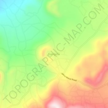
Name: Kangeta topographic map, elevation, terrain.
Location: Kangeta, Kangeta ward, Igembe Central, Meru County, Kenya (0.26330 37.86330 0.30330 37.90330)
Average elevation: 5,837 ft
Minimum elevation: 4,954 ft
Maximum elevation: 6,890 ft
Thank you for supporting this site ❤️
Make a donation
Make a donation
Gear up for your next adventure:
As an Amazon Associate, this site earns from qualifying purchases at no extra cost to you.