Geolocate

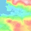
Carndonagh topographic map

Click on the map to display elevation.

About this map

Name: Carndonagh topographic map, elevation, terrain.

Location: Carndonagh, Inishowen Municipal District, County Donegal, Ireland (55.23243 -7.28500 55.26557 -7.24114)

Average elevation: 177 ft

Minimum elevation: 26 ft

Maximum elevation: 607 ft

Other topographic maps

Click on a map to view its topography, its elevation and its terrain.
Donegal

Ireland > County Donegal > Donegal

Average elevation: 157 ft

Newtown Cunningham

Ireland > County Donegal

Average elevation: 82 ft

Greencastle

Ireland > County Donegal

Average elevation: 151 ft

Portsalon

Ireland > County Donegal > Letterkenny

Average elevation: 89 ft

Mamore Gap

Ireland > County Donegal

Average elevation: 630 ft

Fintown

Ireland > County Donegal

Average elevation: 614 ft

Cashel

Ireland > County Donegal

Average elevation: 354 ft

Carndonagh

Ireland > County Donegal > Carndonagh

Average elevation: 256 ft

Maum

Ireland > County Donegal

Average elevation: 587 ft

Gear up for your next adventure:

🔥Camping Stove - Portable stove for camping and backcountry cooking
🧷Carabiner Set - Durable clips for gear attachment
🗻Climbing Gear Basics - Essential gear for beginner climbers
🧭GPS Watch Accessories - Bands and chargers for GPS watches
🪶Camping Sleeping Pad - Comfortable sleeping pad for backpacking

As an Amazon Associate, this site earns from qualifying purchases at no extra cost to you.