
Thank you for supporting this site ❤️
Make a donation
Make a donation
Gear up for your next adventure:
As an Amazon Associate, this site earns from qualifying purchases at no extra cost to you.
Flateyri topographic map
Click on the map to display elevation.
Thank you for supporting this site ❤️
Make a donation
Make a donation
Gear up for your next adventure:
As an Amazon Associate, this site earns from qualifying purchases at no extra cost to you.
About this map
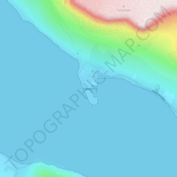
Name: Flateyri topographic map, elevation, terrain.
Location: Flateyri, Ísafjarðarbær, Westfjords Region, 425, Iceland (66.02881 -23.53296 66.06881 -23.49296)
Average elevation: 295 ft
Minimum elevation: -7 ft
Maximum elevation: 2,264 ft
Thank you for supporting this site ❤️
Make a donation
Make a donation
Gear up for your next adventure:
As an Amazon Associate, this site earns from qualifying purchases at no extra cost to you.