
Thank you for supporting this site ❤️
Make a donation
Make a donation
Gear up for your next adventure:
As an Amazon Associate, this site earns from qualifying purchases at no extra cost to you.
Punakaiki topographic map
Click on the map to display elevation.
Thank you for supporting this site ❤️
Make a donation
Make a donation
Gear up for your next adventure:
As an Amazon Associate, this site earns from qualifying purchases at no extra cost to you.
About this map
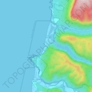
Name: Punakaiki topographic map, elevation, terrain.
Location: Punakaiki, Buller District, West Coast, 7873, New Zealand (-42.12855 171.31531 -42.08855 171.35531)
Average elevation: 230 ft
Minimum elevation: 0 ft
Maximum elevation: 1,401 ft
Thank you for supporting this site ❤️
Make a donation
Make a donation
Gear up for your next adventure:
As an Amazon Associate, this site earns from qualifying purchases at no extra cost to you.