Geolocate

Etoile topographic map

Click on the map to display elevation.

About this map

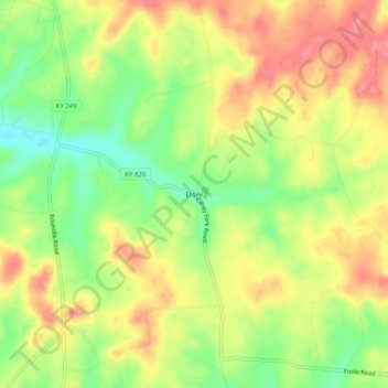
Name: Etoile topographic map, elevation, terrain.

Location: Etoile, Barren County, Kentucky, 42131, United States (36.81561 -85.91998 36.85561 -85.87998)

Average elevation: 807 ft

Minimum elevation: 663 ft

Maximum elevation: 935 ft

Barren County trails, hiking, mountain biking, running and outdoor activities

Gear up for your next adventure:

🥘Titanium Cookware - Durable, featherlight pots and pans for backpacking
❄️Traction Cleats - Prevent slips on icy trails during winter hikes
🪑Ultralight Camp Chairs - Portable seating for resting after a long day of mapping
🧴Hand Sanitizer - Keep hands clean while hiking
🥤Water Filter Bottle - All‑in‑one filter bottle for safe hydration

As an Amazon Associate, this site earns from qualifying purchases at no extra cost to you.