Geolocate

Erdenet topographic map

Click on the map to display elevation.

About this map

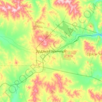
Name: Erdenet topographic map, elevation, terrain.

Location: Erdenet, Bayan-Ondor, Orkhon, 61020, Mongolia (48.86760 103.88439 49.18760 104.20439)

Average elevation: 4,495 ft

Minimum elevation: 3,711 ft

Maximum elevation: 6,040 ft

Gear up for your next adventure:

🛰️Handheld GPS Units - Professional satellite navigators for precise backcountry mapping
📡Handheld GPS Device - Reliable handheld GPS for outdoor navigation
📱Heavy-Duty Phone Cases - Drop-proof and waterproof protection for outdoor navigation
👟Trail Running Shoes - Lightweight shoes for trail runners
❄️Traction Cleats - Prevent slips on icy trails during winter hikes

As an Amazon Associate, this site earns from qualifying purchases at no extra cost to you.