
Thank you for supporting this site ❤️
Make a donation
Make a donation
Gear up for your next adventure:
As an Amazon Associate, this site earns from qualifying purchases at no extra cost to you.
Chyupar Khola topographic map
Click on the map to display elevation.
Thank you for supporting this site ❤️
Make a donation
Make a donation
Gear up for your next adventure:
As an Amazon Associate, this site earns from qualifying purchases at no extra cost to you.
About this map
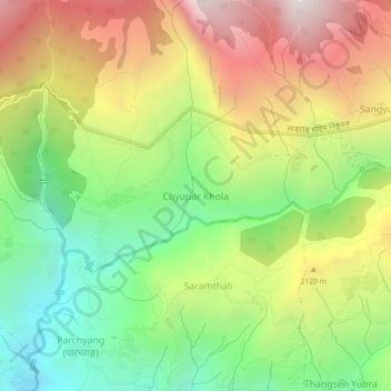
Name: Chyupar Khola topographic map, elevation, terrain.
Location: Chyupar Khola, Naukunda, Rasuwa, Bagmati Province, Nepal (28.00685 85.26696 28.04685 85.30696)
Average elevation: 6,220 ft
Minimum elevation: 3,583 ft
Maximum elevation: 9,495 ft
Thank you for supporting this site ❤️
Make a donation
Make a donation
Gear up for your next adventure:
As an Amazon Associate, this site earns from qualifying purchases at no extra cost to you.