
Mộ Đức District topographic map
Interactive map
Click on the map to display elevation.
About this map
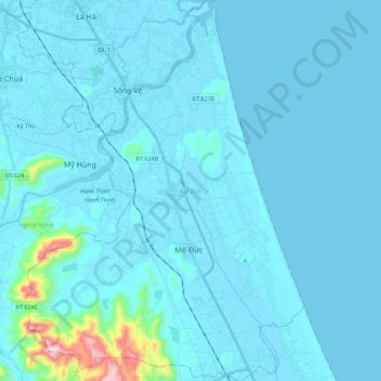
Name: Mộ Đức District topographic map, elevation, terrain.
Location: Mộ Đức District, Quảng Ngãi Province, Vietnam (14.87835 108.79105 15.09387 108.95523)
Average elevation: 115 ft
Minimum elevation: -7 ft
Maximum elevation: 1,942 ft
Other topographic maps
Click on a map to view its topography, its elevation and its terrain.
Quảng Ngãi
Quảng Ngãi, Quảng Ngãi Province, Vietnam
Average elevation: 46 ft
Lý Sơn
Vietnam > Quang Ngai province > Lý Sơn
Lý Sơn, Lý Sơn District, Quảng Ngãi Province, 54400, Vietnam
Average elevation: 30 ft
Đức Phổ
Vietnam > Quang Ngai province > Đức Phổ
Đức Phổ, Town of Duc Pho, Quang Ngai province, Vietnam
Average elevation: 59 ft
Trà Bồng District
Trà Bồng District, Quảng Ngãi Province, Vietnam
Average elevation: 1,224 ft