
Thank you for supporting this site ❤️
Make a donation
Make a donation
Gear up for your next adventure:
As an Amazon Associate, this site earns from qualifying purchases at no extra cost to you.
Al-Rumaithah District topographic map
Click on the map to display elevation.
Thank you for supporting this site ❤️
Make a donation
Make a donation
Gear up for your next adventure:
As an Amazon Associate, this site earns from qualifying purchases at no extra cost to you.
About this map
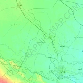
Name: Al-Rumaithah District topographic map, elevation, terrain.
Location: Al-Rumaithah District, Al-Muthanna Governorate, Iraq (31.24128 44.96048 31.75459 45.46226)
Average elevation: 52 ft
Minimum elevation: 26 ft
Maximum elevation: 177 ft
Thank you for supporting this site ❤️
Make a donation
Make a donation
Gear up for your next adventure:
As an Amazon Associate, this site earns from qualifying purchases at no extra cost to you.