
Shafer topographic map
Click on the map to display elevation.
About this map
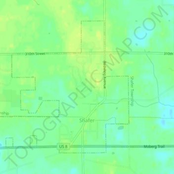
Name: Shafer topographic map, elevation, terrain.
Location: Shafer, Chisago County, Minnesota, United States (45.38177 -92.77460 45.40234 -92.73846)
Average elevation: 942 ft
Minimum elevation: 912 ft
Maximum elevation: 965 ft
Chisago County trails, hiking, mountain biking, running and outdoor activities
Other topographic maps
Click on a map to view its topography, its elevation and its terrain.
Chain Lake
United States > Minnesota > Chisago County > North Branch > Harris
Average elevation: 922 ft