Geolocate

Doorn topographic map

Click on the map to display elevation.

About this map

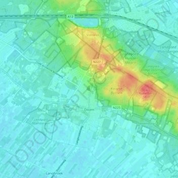
Name: Doorn topographic map, elevation, terrain.

Location: Doorn, Utrechtse Heuvelrug, Utrecht, Netherlands (52.01004 5.29176 52.07077 5.39200)

Average elevation: 46 ft

Minimum elevation: 7 ft

Maximum elevation: 203 ft

Other topographic maps

Click on a map to view its topography, its elevation and its terrain.

Amersfoortse Berg

Netherlands > Utrecht > Amersfoort

Average elevation: 62 ft

Cabauw

Netherlands > Utrecht

Average elevation: -3 ft

Palestina

Netherlands > Utrecht > Amersfoort

Average elevation: 7 ft

Breedeveen

Netherlands > Utrecht > Leersum

Average elevation: 49 ft

Amerongse Berg

Netherlands > Utrecht > Amerongen

Average elevation: 112 ft

Eembrugge

Netherlands > Utrecht > Baarn

Average elevation: 3 ft

Graaf

Netherlands > Utrecht > Lopik

Average elevation: 0 ft

Gear up for your next adventure:

🏔️Mountain Trail Maps - High‑detail maps for popular peaks
🪄Magnetic Compass - Accurate compass for navigation
🧤Hiking Gloves - Protective gloves for rugged trails
🚑Emergency Bivvies - Heat-reflective sleeping bags for survival situations
📱Solar Portable Charger - Solar power bank for charging devices off‑grid

As an Amazon Associate, this site earns from qualifying purchases at no extra cost to you.