Geolocate

Pacay topographic map

Click on the map to display elevation.

About this map

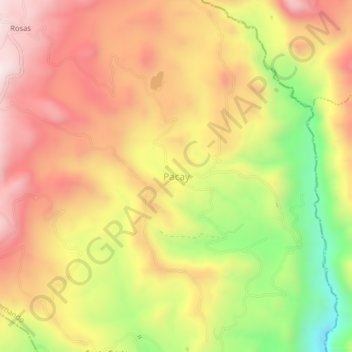
Name: Pacay topographic map, elevation, terrain.

Location: Pacay, San Fernando, Azuay, Ecuador (-3.20155 -79.25072 -3.16155 -79.21072)

Average elevation: 7,507 ft

Minimum elevation: 6,142 ft

Maximum elevation: 8,533 ft

Other topographic maps

Click on a map to view its topography, its elevation and its terrain.

Chumblín

Ecuador > Azuay > San Fernando

Average elevation: 11,047 ft

Gear up for your next adventure:

👟Men's Trail Runners - Lightweight footwear for fast-paced exploration and light hiking
🥾Men's Hiking Boots - Durable, waterproof footwear for rugged terrain and steep inclines
🛰️Handheld GPS Units - Professional satellite navigators for precise backcountry mapping
🩳Quick‑Dry Hiking Shorts - Comfortable and quick‑dry shorts for summer hiking
🧯Emergency Survival Kit - All‑in‑one survival essentials for the backcountry

As an Amazon Associate, this site earns from qualifying purchases at no extra cost to you.