
Make a donation
Gear up for your next adventure:
As an Amazon Associate, this site earns from qualifying purchases at no extra cost to you.
Neumühle topographic map
Click on the map to display elevation.
Make a donation
Gear up for your next adventure:
As an Amazon Associate, this site earns from qualifying purchases at no extra cost to you.
Neumühle
Neumühle liegt auf etwa 370 Meter Höhe am Volletsbach. Oberhalb der Ortschaft steht das Schloss Greifenstein. Nachbarorte sind im Norden Reckendorf, im Nordosten Schloss Greifenstein, im Süden Heiligenstadt und im Südwesten Zoggendorf.
Make a donation
Gear up for your next adventure:
As an Amazon Associate, this site earns from qualifying purchases at no extra cost to you.
About this map
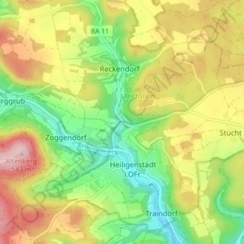
Name: Neumühle topographic map, elevation, terrain.
Average elevation: 1,486 ft
Minimum elevation: 1,132 ft
Maximum elevation: 1,919 ft
Make a donation
Gear up for your next adventure:
As an Amazon Associate, this site earns from qualifying purchases at no extra cost to you.