
Thank you for supporting this site ❤️
Make a donation
Make a donation
Gear up for your next adventure:
As an Amazon Associate, this site earns from qualifying purchases at no extra cost to you.
Tala topographic map
Click on the map to display elevation.
Thank you for supporting this site ❤️
Make a donation
Make a donation
Gear up for your next adventure:
As an Amazon Associate, this site earns from qualifying purchases at no extra cost to you.
About this map
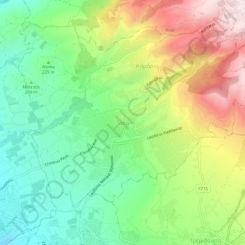
Name: Tala topographic map, elevation, terrain.
Location: Tala, Κοινότητα Τάλας, Paphos District, 8577, Cyprus (34.81613 32.41098 34.85613 32.45098)
Average elevation: 938 ft
Minimum elevation: 184 ft
Maximum elevation: 2,090 ft
Thank you for supporting this site ❤️
Make a donation
Make a donation
Gear up for your next adventure:
As an Amazon Associate, this site earns from qualifying purchases at no extra cost to you.