
Thank you for supporting this site ❤️
Make a donation
Make a donation
Gear up for your next adventure:
As an Amazon Associate, this site earns from qualifying purchases at no extra cost to you.
A Lagoa topographic map
Click on the map to display elevation.
Thank you for supporting this site ❤️
Make a donation
Make a donation
Gear up for your next adventure:
As an Amazon Associate, this site earns from qualifying purchases at no extra cost to you.
About this map
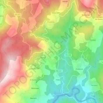
Name: A Lagoa topographic map, elevation, terrain.
Location: A Lagoa, Campo Lameiro, Pontevedra, Galicia, 36110, España (42.52017 -8.56398 42.56017 -8.52398)
Average elevation: 935 ft
Minimum elevation: 207 ft
Maximum elevation: 1,752 ft
Thank you for supporting this site ❤️
Make a donation
Make a donation
Gear up for your next adventure:
As an Amazon Associate, this site earns from qualifying purchases at no extra cost to you.