Geolocate

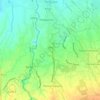
Alingaro topographic map

Click on the map to display elevation.

About this map

Name: Alingaro topographic map, elevation, terrain.

Location: Alingaro, General Trias, Cavite, Calabarzon, 4107, Philippines (14.22019 120.88922 14.25603 120.92054)

Average elevation: 751 ft

Minimum elevation: 538 ft

Maximum elevation: 932 ft

Other topographic maps

Click on a map to view its topography, its elevation and its terrain.

Block 22

Philippines > Cavite > General Trias

Average elevation: 85 ft

Tapia

Philippines > Cavite > General Trias > Tapia

Average elevation: 105 ft

Malabon River

Philippines > Cavite > General Trias

Average elevation: 52 ft

Kaliwa Dam

Philippines > Cavite > General Trias

Average elevation: 72 ft

Kaliwa Dam

Philippines > Cavite > General Trias

Average elevation: 72 ft

Kaliwa Dam

Philippines > Cavite > General Trias

Average elevation: 72 ft

Gear up for your next adventure:

💧Water Filtration Bottles - Safely drink from streams and lakes while exploring
🏔️Mountain Trail Maps - High‑detail maps for popular peaks
🌡️Handheld Weather Meters - Measure wind, temp, and pressure for safe mountain travel
🌧️Backpack Rain Cover - Keep gear dry in wet weather
🧭Orienteering Set - Complete compass and map reading kit

As an Amazon Associate, this site earns from qualifying purchases at no extra cost to you.