
Thank you for supporting this site ❤️
Make a donation
Make a donation
Gear up for your next adventure:
As an Amazon Associate, this site earns from qualifying purchases at no extra cost to you.
Eppegem topographic map
Click on the map to display elevation.
Thank you for supporting this site ❤️
Make a donation
Make a donation
Gear up for your next adventure:
As an Amazon Associate, this site earns from qualifying purchases at no extra cost to you.
About this map
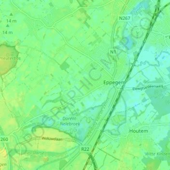
Name: Eppegem topographic map, elevation, terrain.
Location: Eppegem, Zemst, Hal-Vilvorde, Brabant flamand, Flandre, Belgique (50.94653 4.41253 50.97485 4.47753)
Average elevation: 36 ft
Minimum elevation: 10 ft
Maximum elevation: 62 ft
Thank you for supporting this site ❤️
Make a donation
Make a donation
Gear up for your next adventure:
As an Amazon Associate, this site earns from qualifying purchases at no extra cost to you.
Other topographic maps
Click on a map to view its topography, its elevation and its terrain.