
Make a donation
Gear up for your next adventure:
As an Amazon Associate, this site earns from qualifying purchases at no extra cost to you.
Klingemühle topographic map
Click on the map to display elevation.
Make a donation
Gear up for your next adventure:
As an Amazon Associate, this site earns from qualifying purchases at no extra cost to you.
Klingemühle
Johann Gottfried Kapke heiratete die Witwe und wurde so zum neuen Klingemüller. Noch vor dem Ende des 18. Jahrhunderts folgte ein Besitzer namens Schmettow, der die Klingemühle 1803 an Christian Richter verkaufte. Richter hatte nun die Aufgabe, die heruntergekommene Mühle wieder instand zu setzen. Er erlitt jedoch große Schäden im Vierten Koalitionskrieg 1806–1807, die er auf 3.000 Taler bezifferte. Der Topographisch-militairische Atlas von dem Koenigreiche Sachsen von 1810 verzeichnet die Mühle als Klingelmühle. 1818 standen im Wohnort Klingemühle zwei Wohnhäuser, die 30 Bewohner hatten. 1840 gab es nur noch ein Wohnhaus, in dem aber 25 Personen wohnten. 1846 wurden die Dienste und Prästationen (Abgaben) des im Regest namentlich nicht genannten Mühlenbesitzers zur Standesherrschaft Friedland abgelöst.
Make a donation
Gear up for your next adventure:
As an Amazon Associate, this site earns from qualifying purchases at no extra cost to you.
About this map
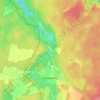
Name: Klingemühle topographic map, elevation, terrain.
Average elevation: 292 ft
Minimum elevation: 157 ft
Maximum elevation: 404 ft
Make a donation
Gear up for your next adventure:
As an Amazon Associate, this site earns from qualifying purchases at no extra cost to you.