
Thank you for supporting this site ❤️
Make a donation
Make a donation
Gear up for your next adventure:
As an Amazon Associate, this site earns from qualifying purchases at no extra cost to you.
Gafsa topographic map
Click on the map to display elevation.
Thank you for supporting this site ❤️
Make a donation
Make a donation
Gear up for your next adventure:
As an Amazon Associate, this site earns from qualifying purchases at no extra cost to you.
About this map
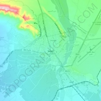
Name: Gafsa topographic map, elevation, terrain.
Location: Gafsa, وادي أيلو, معتمدية قفصة الجنوبية, Gafsa, 2100, Tunisia (34.26244 8.62439 34.58244 8.94439)
Average elevation: 1,102 ft
Minimum elevation: 509 ft
Maximum elevation: 3,707 ft
Thank you for supporting this site ❤️
Make a donation
Make a donation
Gear up for your next adventure:
As an Amazon Associate, this site earns from qualifying purchases at no extra cost to you.