Geolocate

Cireglio topographic map

Click on the map to display elevation.

About this map

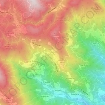
Name: Cireglio topographic map, elevation, terrain.

Location: Cireglio, Pistoia, Tuscany, 51100, Italy (43.97453 10.83404 44.01453 10.87404)

Average elevation: 1,932 ft

Minimum elevation: 646 ft

Maximum elevation: 3,117 ft

Gear up for your next adventure:

🗺️Topographic Maps - Detailed topo maps for hiking, exploring and outdoor navigation
🎒Day Hiking Backpack - Lightweight backpack perfect for day trips and outdoor adventures
🔥Plasma Lighters - Windproof lighters that work in any weather condition
🥘Titanium Cookware - Durable, featherlight pots and pans for backpacking
🦶Hiking Gaiters - Keep debris and water out of your boots

As an Amazon Associate, this site earns from qualifying purchases at no extra cost to you.