Geolocate

Valley topographic map

Click on the map to display elevation.

About this map

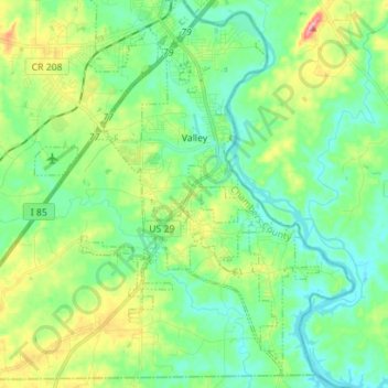
Name: Valley topographic map, elevation, terrain.

Location: Valley, Chambers County, Alabama, United States (32.74638 -85.27455 32.85648 -85.13434)

Average elevation: 627 ft

Minimum elevation: 518 ft

Maximum elevation: 889 ft

Chambers County trails, hiking, mountain biking, running and outdoor activities

Other topographic maps

Click on a map to view its topography, its elevation and its terrain.

New Harmony

United States > Alabama > Chambers County

Average elevation: 748 ft

Cusseta

United States > Alabama > Chambers County

Average elevation: 696 ft

White Plains

United States > Alabama > Chambers County

Average elevation: 814 ft

Stroud

United States > Alabama > Chambers County

Average elevation: 804 ft

Gear up for your next adventure:

🌎3D Topographic Globes - Raised relief globes for a tactile understanding of geography
🧥Waterproof Jacket for Hiking - Breathable and rugged rain jacket for outdoor excursions
🦶Carbon Trekking Poles - Reduce knee impact on steep descents with ultra-light poles
🪶Trail Camera - Capture wildlife on your hikes
📦Gear Storage Bags - Organize and protect outdoor equipment

As an Amazon Associate, this site earns from qualifying purchases at no extra cost to you.