Geolocate

Alcañiz topographic map

Click on the map to display elevation.

About this map

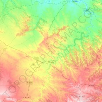
Name: Alcañiz topographic map, elevation, terrain.

Location: Alcañiz, Bajo Aragón, Teruel, Aragon, Spain (40.97551 -0.37625 41.19201 0.03692)

Average elevation: 1,194 ft

Minimum elevation: 354 ft

Maximum elevation: 2,283 ft

Gear up for your next adventure:

🔭Telescopic Hiking Pole - Adjustable pole for hiking stability
🪶Camping Sleeping Pad - Comfortable sleeping pad for backpacking
🧭Hiking Compass - Precision compass for reliable navigation in the wilderness
🧭Map Reading Tools - Tools and kits for map navigation
🪶Thermal Camp Blanket - Extra warmth for cold nights

As an Amazon Associate, this site earns from qualifying purchases at no extra cost to you.