
Gisenyi topographic map
Interactive map
Click on the map to display elevation.
About this map
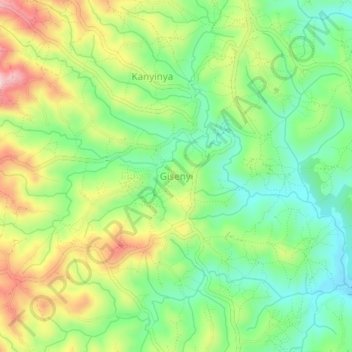
Name: Gisenyi topographic map, elevation, terrain.
Location: Gisenyi, Makamba, Burundi (-4.22603 29.74261 -4.18603 29.78261)
Average elevation: 4,879 ft
Minimum elevation: 4,551 ft
Maximum elevation: 5,371 ft
Other topographic maps
Click on a map to view its topography, its elevation and its terrain.