
Bukeye topographic map
Interactive map
Click on the map to display elevation.
About this map
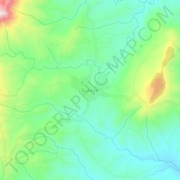
Name: Bukeye topographic map, elevation, terrain.
Location: Bukeye, Makamba, Burundi (-4.32015 29.89498 -4.28015 29.93498)
Average elevation: 4,498 ft
Minimum elevation: 4,150 ft
Maximum elevation: 5,292 ft
Other topographic maps
Click on a map to view its topography, its elevation and its terrain.