
Thank you for supporting this site ❤️
Make a donation
Make a donation
Gear up for your next adventure:
As an Amazon Associate, this site earns from qualifying purchases at no extra cost to you.
Moscete topographic map
Click on the map to display elevation.
Thank you for supporting this site ❤️
Make a donation
Make a donation
Gear up for your next adventure:
As an Amazon Associate, this site earns from qualifying purchases at no extra cost to you.
About this map
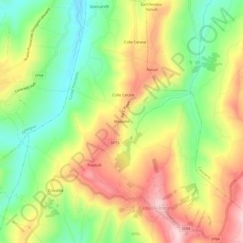
Name: Moscete topographic map, elevation, terrain.
Location: Moscete, Castel Frentano, Chieti, Abruzzo, 66032, Italia (42.19137 14.32740 42.23137 14.36740)
Average elevation: 837 ft
Minimum elevation: 427 ft
Maximum elevation: 1,296 ft
Thank you for supporting this site ❤️
Make a donation
Make a donation
Gear up for your next adventure:
As an Amazon Associate, this site earns from qualifying purchases at no extra cost to you.