
Zahedan topographic map
Click on the map to display elevation.
Zahedan
Zahedan is connected by rail to nearby Pakistan and is near to Afghanistan. It is about 41 km (25 mi) south of the tripoint of the three countries and at an altitude of 1,352 m (4,436 ft) above sea level and 1,605 km (997 mi) from the Iranian capital of Tehran.
About this map
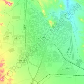
Name: Zahedan topographic map, elevation, terrain.
Average elevation: 4,623 ft
Minimum elevation: 4,288 ft
Maximum elevation: 5,650 ft
Other topographic maps
Click on a map to view its topography, its elevation and its terrain.
Malek Abad
Iran > Sistan and Baluchestan Province > Zahedan County > دهستان حرمک
Average elevation: 3,140 ft
Pardisan Park
Iran > Sistan and Baluchestan Province > Zahedan County > Zahedan
Average elevation: 4,593 ft