
Make a donation
Gear up for your next adventure:
As an Amazon Associate, this site earns from qualifying purchases at no extra cost to you.
O Pereiro topographic map
Click on the map to display elevation.
Make a donation
Gear up for your next adventure:
As an Amazon Associate, this site earns from qualifying purchases at no extra cost to you.
O Pereiro
Sus límites son: al oeste, el municipio de La Gudiña; al norte, el de Viana del Bollo; al nordeste y este, la provincia de Zamora, y al sur, Portugal. La altitud del término municipal sobrepasa los 800 msnm, lo que ha dificultado, históricamente, una población más densa de su territorio. El río Diabredo pasa por el pueblo.
Make a donation
Gear up for your next adventure:
As an Amazon Associate, this site earns from qualifying purchases at no extra cost to you.
About this map
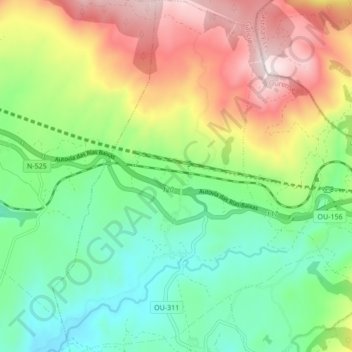
Name: O Pereiro topographic map, elevation, terrain.
Location: O Pereiro, A Mezquita, Viana, Orense, Galicia, España (42.01355 -7.08307 42.07666 -7.01802)
Average elevation: 3,671 ft
Minimum elevation: 2,966 ft
Maximum elevation: 4,813 ft
Make a donation
Gear up for your next adventure:
As an Amazon Associate, this site earns from qualifying purchases at no extra cost to you.