
Memphis topographic map
Interactive map
Click on the map to display elevation.
About this map
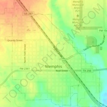
Name: Memphis topographic map, elevation, terrain.
Location: Memphis, Hall County, Texas, United States (34.71415 -100.55840 34.74353 -100.52469)
Average elevation: 2,073 ft
Minimum elevation: 1,991 ft
Maximum elevation: 2,136 ft
Other topographic maps
Click on a map to view its topography, its elevation and its terrain.
Turkey
United States > Texas > Hall County
Turkey, Hall County, Texas, 79261, United States
Average elevation: 2,359 ft
Plaska
United States > Texas > Hall County
Plaska, Hall County, Texas, United States
Average elevation: 1,952 ft
Brice
United States > Texas > Hall County
Brice, Hall County, Texas, United States
Average elevation: 2,211 ft
Lakeview
United States > Texas > Hall County
Lakeview, Hall County, Texas, United States
Average elevation: 2,129 ft
Estelline
United States > Texas > Hall County
Estelline, Hall County, Texas, 79233, United States
Average elevation: 1,811 ft
Memphis
United States > Texas > Hall County > Memphis > Memphis
Memphis, Hall County, Texas, 79245, United States
Average elevation: 2,083 ft