
Thank you for supporting this site ❤️
Make a donation
Make a donation
Gear up for your next adventure:
As an Amazon Associate, this site earns from qualifying purchases at no extra cost to you.
Berrouaghia topographic map
Click on the map to display elevation.
Thank you for supporting this site ❤️
Make a donation
Make a donation
Gear up for your next adventure:
As an Amazon Associate, this site earns from qualifying purchases at no extra cost to you.
About this map
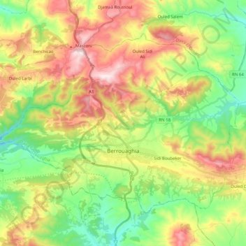
Name: Berrouaghia topographic map, elevation, terrain.
Location: Berrouaghia, Berrouaghia District, Médéa, Algeria (36.09456 2.81259 36.21203 3.01140)
Average elevation: 3,120 ft
Minimum elevation: 2,267 ft
Maximum elevation: 4,334 ft
Thank you for supporting this site ❤️
Make a donation
Make a donation
Gear up for your next adventure:
As an Amazon Associate, this site earns from qualifying purchases at no extra cost to you.