
Thank you for supporting this site ❤️
Make a donation
Make a donation
Gear up for your next adventure:
As an Amazon Associate, this site earns from qualifying purchases at no extra cost to you.
Whitetail topographic map
Click on the map to display elevation.
Thank you for supporting this site ❤️
Make a donation
Make a donation
Gear up for your next adventure:
As an Amazon Associate, this site earns from qualifying purchases at no extra cost to you.
About this map
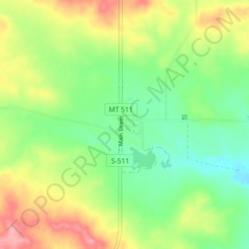
Name: Whitetail topographic map, elevation, terrain.
Location: Whitetail, Daniels County, Montana, 59276, United States (48.87568 -105.18301 48.91568 -105.14301)
Average elevation: 2,569 ft
Minimum elevation: 2,425 ft
Maximum elevation: 2,779 ft
Daniels County trails, hiking, mountain biking, running and outdoor activities
Thank you for supporting this site ❤️
Make a donation
Make a donation
Gear up for your next adventure:
As an Amazon Associate, this site earns from qualifying purchases at no extra cost to you.