Geolocate

Shaw topographic map

Click on the map to display elevation.

About this map

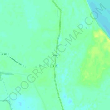
Name: Shaw topographic map, elevation, terrain.

Location: Shaw, Concordia Parish, Louisiana, United States (31.17158 -91.65139 31.21158 -91.61139)

Average elevation: 56 ft

Minimum elevation: 33 ft

Maximum elevation: 89 ft

Other topographic maps

Click on a map to view its topography, its elevation and its terrain.

Ferriday

United States > Louisiana > Concordia Parish

Average elevation: 59 ft

Clayton

United States > Louisiana > Concordia Parish

Average elevation: 59 ft

Gear up for your next adventure:

📦Gear Storage Bags - Organize and protect outdoor equipment
😴Insulated Sleeping Pads - Compact and warm pads for high-elevation camping
🔦Powerful Headlamps - Ultra-bright hands-free lighting for night navigation
🦶Carbon Trekking Poles - Reduce knee impact on steep descents with ultra-light poles
🔥Camping Stove - Portable stove for camping and backcountry cooking

As an Amazon Associate, this site earns from qualifying purchases at no extra cost to you.