
永吉县 topographic map
Interactive map
Click on the map to display elevation.
About this map
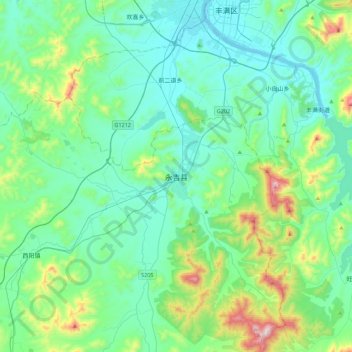
Name: 永吉县 topographic map, elevation, terrain.
Location: 永吉县, 吉林市, 吉林省, 中国 (43.50729 126.33511 43.82729 126.65511)
Average elevation: 1,099 ft
Minimum elevation: 610 ft
Maximum elevation: 3,222 ft
Other topographic maps
Click on a map to view its topography, its elevation and its terrain.