
北极村 topographic map
Interactive map
Click on the map to display elevation.
About this map
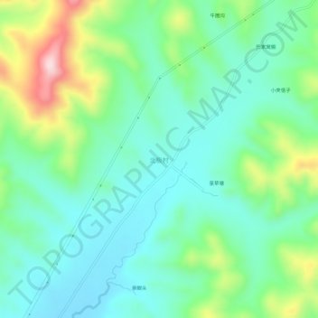
Name: 北极村 topographic map, elevation, terrain.
Location: 北极村, 永吉县, 吉林市, 吉林省, 中国 (43.60993 126.15180 43.64993 126.19180)
Average elevation: 1,194 ft
Minimum elevation: 912 ft
Maximum elevation: 1,919 ft
Other topographic maps
Click on a map to view its topography, its elevation and its terrain.