
Thank you for supporting this site ❤️
Make a donation
Make a donation
Gear up for your next adventure:
As an Amazon Associate, this site earns from qualifying purchases at no extra cost to you.
Kallayi topographic map
Click on the map to display elevation.
Thank you for supporting this site ❤️
Make a donation
Make a donation
Gear up for your next adventure:
As an Amazon Associate, this site earns from qualifying purchases at no extra cost to you.
About this map
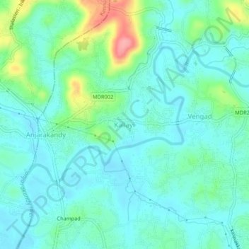
Name: Kallayi topographic map, elevation, terrain.
Location: Kallayi, Thalassery, Kannur district, Kerala, 670612, India (11.86257 75.50072 11.90257 75.54072)
Average elevation: 85 ft
Minimum elevation: 7 ft
Maximum elevation: 351 ft
Thank you for supporting this site ❤️
Make a donation
Make a donation
Gear up for your next adventure:
As an Amazon Associate, this site earns from qualifying purchases at no extra cost to you.