
Make a donation
Gear up for your next adventure:
As an Amazon Associate, this site earns from qualifying purchases at no extra cost to you.
Ernstburg topographic map
Click on the map to display elevation.
Make a donation
Gear up for your next adventure:
As an Amazon Associate, this site earns from qualifying purchases at no extra cost to you.
About this map
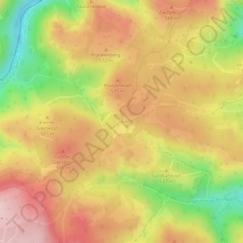
Name: Ernstburg topographic map, elevation, terrain.
Average elevation: 1,745 ft
Minimum elevation: 1,217 ft
Maximum elevation: 2,139 ft
Make a donation
Gear up for your next adventure:
As an Amazon Associate, this site earns from qualifying purchases at no extra cost to you.
Other topographic maps
Click on a map to view its topography, its elevation and its terrain.
Darlingerode
Deutschland > Sachsen-Anhalt > Landkreis Harz > Ilsenburg
Darlingerode liegt am Nordrand des Harzes zwischen Wernigerode und Drübeck in einer Höhe von 260 bis 300 m, nach Norden hin erstreckt sich die sanft wellige Landschaft des nördlichen Harzvorlandes, im Süden steigt hinter den letzten Häusern steil der Hochharz empor, westlich und östlich begleiten den Ort…
Average elevation: 840 ft
Untere Zeterklippen
Deutschland > Sachsen-Anhalt > Landkreis Harz > Ilsenburg
Average elevation: 2,503 ft
Drübeck
Deutschland > Sachsen-Anhalt > Landkreis Harz > Ilsenburg
Drübeck liegt auf einer Höhe von 258 m ü. NN am Nordrand des Harzes zwischen Darlingerode im Osten und Ilsenburg (Harz) im Westen. Südlich des Dorfes liegt Oehrenfeld.
Average elevation: 1,053 ft