
Thank you for supporting this site ❤️
Make a donation
Make a donation
Gear up for your next adventure:
As an Amazon Associate, this site earns from qualifying purchases at no extra cost to you.
Taşyatak topographic map
Click on the map to display elevation.
Thank you for supporting this site ❤️
Make a donation
Make a donation
Gear up for your next adventure:
As an Amazon Associate, this site earns from qualifying purchases at no extra cost to you.
About this map
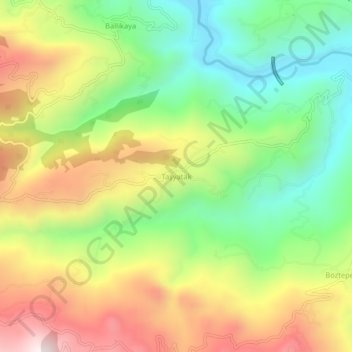
Name: Taşyatak topographic map, elevation, terrain.
Location: Taşyatak, Akyazı, Sakarya, Marmara Region, Turkey (40.54894 30.65096 40.58894 30.69096)
Average elevation: 1,611 ft
Minimum elevation: 423 ft
Maximum elevation: 3,143 ft
Thank you for supporting this site ❤️
Make a donation
Make a donation
Gear up for your next adventure:
As an Amazon Associate, this site earns from qualifying purchases at no extra cost to you.