
Thank you for supporting this site ❤️
Make a donation
Make a donation
Gear up for your next adventure:
As an Amazon Associate, this site earns from qualifying purchases at no extra cost to you.
Jibacoa topographic map
Click on the map to display elevation.
Thank you for supporting this site ❤️
Make a donation
Make a donation
Gear up for your next adventure:
As an Amazon Associate, this site earns from qualifying purchases at no extra cost to you.
About this map
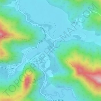
Name: Jibacoa topographic map, elevation, terrain.
Location: Jibacoa, Manicaragua, Villa Clara, 54590, Cuba (22.02081 -79.98493 22.02085 -79.98490)
Average elevation: 1,325 ft
Minimum elevation: 1,079 ft
Maximum elevation: 2,110 ft
Thank you for supporting this site ❤️
Make a donation
Make a donation
Gear up for your next adventure:
As an Amazon Associate, this site earns from qualifying purchases at no extra cost to you.