Geolocate

Rivetto topographic map

Click on the map to display elevation.

About this map

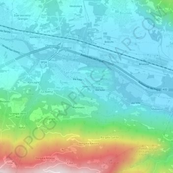
Name: Rivetto topographic map, elevation, terrain.

Location: Rivetto, San Giorio di Susa, Turin, Piedmont, 10053, Italy (45.10524 7.16282 45.14524 7.20282)

Average elevation: 1,913 ft

Minimum elevation: 1,316 ft

Maximum elevation: 3,957 ft

Gear up for your next adventure:

🌧️Backpack Rain Cover - Keep gear dry in wet weather
🪶Camping Sleeping Pad - Comfortable sleeping pad for backpacking
🪶Camp Gear Gift Set - Perfect gift bundle for outdoor fans
🔭Telescopic Hiking Pole - Adjustable pole for hiking stability
🧭Orienteering Set - Complete compass and map reading kit

As an Amazon Associate, this site earns from qualifying purchases at no extra cost to you.