
Thank you for supporting this site ❤️
Make a donation
Make a donation
Gear up for your next adventure:
As an Amazon Associate, this site earns from qualifying purchases at no extra cost to you.
Zeddine topographic map
Click on the map to display elevation.
Thank you for supporting this site ❤️
Make a donation
Make a donation
Gear up for your next adventure:
As an Amazon Associate, this site earns from qualifying purchases at no extra cost to you.
About this map
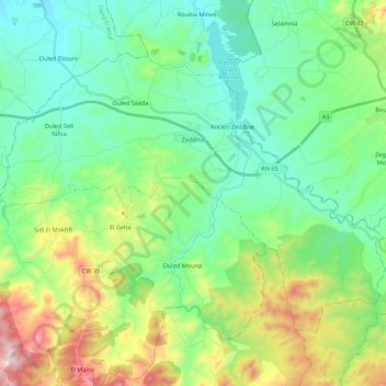
Name: Zeddine topographic map, elevation, terrain.
Location: Zeddine, Daïra Rouina, Aïn Defla, 44031, Algérie (36.06741 1.71089 36.19589 1.92941)
Average elevation: 1,306 ft
Minimum elevation: 607 ft
Maximum elevation: 3,143 ft
Thank you for supporting this site ❤️
Make a donation
Make a donation
Gear up for your next adventure:
As an Amazon Associate, this site earns from qualifying purchases at no extra cost to you.