Geolocate

Inac topographic map

Click on the map to display elevation.

About this map

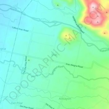
Name: Inac topographic map, elevation, terrain.

Location: Inac, Magpet, Cotabato, Soccsksargen, 9404, Philippines (7.09568 125.07102 7.13568 125.11102)

Average elevation: 712 ft

Minimum elevation: 492 ft

Maximum elevation: 1,444 ft

Gear up for your next adventure:

Camping Coffee Makers - Enjoy premium coffee at the summit or campsite
🧯Portable Fire Pit - Compact fire pit for camping spots
👟Men's Trail Runners - Lightweight footwear for fast-paced exploration and light hiking
🔭Stargazing Telescopes - Perfect for camping in low-light pollution areas shown on maps
📷Action Cameras - Rugged cameras to document your journeys across rugged terrain

As an Amazon Associate, this site earns from qualifying purchases at no extra cost to you.