
Thank you for supporting this site ❤️
Make a donation
Make a donation
Gear up for your next adventure:
As an Amazon Associate, this site earns from qualifying purchases at no extra cost to you.
Kiminini topographic map
Click on the map to display elevation.
Thank you for supporting this site ❤️
Make a donation
Make a donation
Gear up for your next adventure:
As an Amazon Associate, this site earns from qualifying purchases at no extra cost to you.
About this map
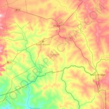
Name: Kiminini topographic map, elevation, terrain.
Location: Kiminini, Trans-Nzoia County, Rift Valley, Kenya (0.80687 34.79590 1.05891 35.11689)
Average elevation: 5,951 ft
Minimum elevation: 5,394 ft
Maximum elevation: 6,585 ft
Thank you for supporting this site ❤️
Make a donation
Make a donation
Gear up for your next adventure:
As an Amazon Associate, this site earns from qualifying purchases at no extra cost to you.