
Thank you for supporting this site ❤️
Make a donation
Make a donation
Gear up for your next adventure:
As an Amazon Associate, this site earns from qualifying purchases at no extra cost to you.
Promaschtgel topographic map
Click on the map to display elevation.
Thank you for supporting this site ❤️
Make a donation
Make a donation
Gear up for your next adventure:
As an Amazon Associate, this site earns from qualifying purchases at no extra cost to you.
About this map
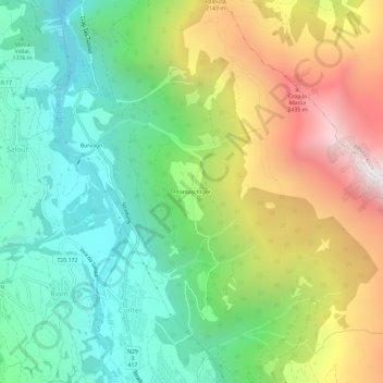
Name: Promaschtgel topographic map, elevation, terrain.
Location: Promaschtgel, Conters, Surses, Albula, Graubünden, 7452, Schweiz (46.59993 9.58186 46.63993 9.62186)
Average elevation: 5,459 ft
Minimum elevation: 3,350 ft
Maximum elevation: 8,993 ft
Thank you for supporting this site ❤️
Make a donation
Make a donation
Gear up for your next adventure:
As an Amazon Associate, this site earns from qualifying purchases at no extra cost to you.