
Glazov topographic map
Interactive map
Click on the map to display elevation.
About this map
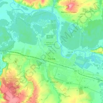
Name: Glazov topographic map, elevation, terrain.
Location: Glazov, Udmurtia, Volga Federal District, Russia (58.10356 52.53648 58.19299 52.75593)
Average elevation: 515 ft
Minimum elevation: 423 ft
Maximum elevation: 755 ft
Other topographic maps
Click on a map to view its topography, its elevation and its terrain.