Geolocate

Firestone topographic map

Click on the map to display elevation.

About this map

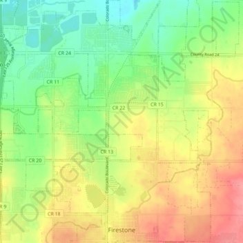
Name: Firestone topographic map, elevation, terrain.

Location: Firestone, Colorado, United States (40.10890 -104.97976 40.17482 -104.89491)

Average elevation: 4,921 ft

Minimum elevation: 4,800 ft

Maximum elevation: 5,059 ft

Colorado trails, hiking, mountain biking, running and outdoor activities

Gear up for your next adventure:

🥩Freeze-Dried Meals - Nutritious and lightweight food for remote expeditions
🧭Pro Hiking Compasses - High-accuracy liquid-filled compasses for topographic orientation
🧦Hiking Socks - Comfortable socks to prevent blisters on long hikes
🔥Plasma Lighters - Windproof lighters that work in any weather condition
🛰️Satellite Messengers - Emergency SOS and two-way messaging for off-grid adventures

As an Amazon Associate, this site earns from qualifying purchases at no extra cost to you.