Geolocate

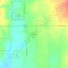
Severance topographic map

Click on the map to display elevation.

About this map

Name: Severance topographic map, elevation, terrain.

Location: Severance, Weld County, Colorado, 80546, United States (40.49675 -104.90831 40.58684 -104.83146)

Average elevation: 4,957 ft

Minimum elevation: 4,806 ft

Maximum elevation: 5,220 ft

Other topographic maps

Click on a map to view its topography, its elevation and its terrain.
Briggsdale

United States > Colorado > Weld County

Average elevation: 4,865 ft

Firestone

United States > Colorado > Weld County

Average elevation: 4,921 ft

Keenesburg

United States > Colorado > Weld County

Average elevation: 4,964 ft

Elwell

United States > Colorado > Weld County > Johnstown

Average elevation: 4,898 ft

Mumper Corner

United States > Colorado > Weld County > Greeley

Average elevation: 4,692 ft

Briggsdale

United States > Colorado > Weld County

Average elevation: 4,865 ft

Adna

United States > Colorado > Weld County > Milliken

Average elevation: 4,770 ft

Elwell

United States > Colorado > Weld County > Johnstown

Average elevation: 4,898 ft

Saint Vrain State Park

United States > Colorado > Weld County > Firestone

The land of St. Vrain State Park was originally home to Ute, Arapaho, and Cheyenne Native American tribes. Once claimed by Spain then France who sold it to the United States in 1803 as part of the Louisiana Purchase. Having just made the largest land purchase in the history of the nation, the government was…

Average elevation: 4,856 ft

Windsor

United States > Colorado > Weld County > Windsor > Windsor

Some days in the winter and spring can be warm and extremely dry, with Chinook winds often raising temperatures to near 70 °F (21 °C) in January and February, and sometimes to near 90 °F (32 °C) in April. Windsor's elevation and low year-round humidity means that nighttime low temperatures are practically…

Average elevation: 4,826 ft

New Raymer

United States > Colorado > Weld County > Raymer

Average elevation: 4,780 ft

Liberty

United States > Colorado > Weld County

Average elevation: 4,997 ft

Firestone

United States > Colorado > Weld County

Average elevation: 4,921 ft

Gear up for your next adventure:

🛰️Satellite Messengers - Emergency SOS and two-way messaging for off-grid adventures
🔥Fast-Boil Camping Stoves - Efficient cooking systems for quick trail meals
🔭Compact Binoculars - HD vision for scouting terrain and identifying distant landmarks
📡GPS Antenna Upgrade - Enhance GPS reception in remote terrain
🗻Climbing Gear Basics - Essential gear for beginner climbers

As an Amazon Associate, this site earns from qualifying purchases at no extra cost to you.