
Thank you for supporting this site ❤️
Make a donation
Make a donation
Gear up for your next adventure:
As an Amazon Associate, this site earns from qualifying purchases at no extra cost to you.
Ned topographic map
Click on the map to display elevation.
Thank you for supporting this site ❤️
Make a donation
Make a donation
Gear up for your next adventure:
As an Amazon Associate, this site earns from qualifying purchases at no extra cost to you.
About this map
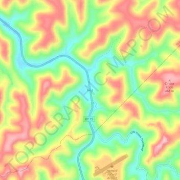
Name: Ned topographic map, elevation, terrain.
Location: Ned, Breathitt County, Kentucky, 41736, United States (37.38843 -83.29073 37.42843 -83.25073)
Average elevation: 1,122 ft
Minimum elevation: 794 ft
Maximum elevation: 1,460 ft
Thank you for supporting this site ❤️
Make a donation
Make a donation
Gear up for your next adventure:
As an Amazon Associate, this site earns from qualifying purchases at no extra cost to you.