
Thank you for supporting this site ❤️
Make a donation
Make a donation
Gear up for your next adventure:
As an Amazon Associate, this site earns from qualifying purchases at no extra cost to you.
Uttendorf topographic map
Click on the map to display elevation.
Thank you for supporting this site ❤️
Make a donation
Make a donation
Gear up for your next adventure:
As an Amazon Associate, this site earns from qualifying purchases at no extra cost to you.
About this map
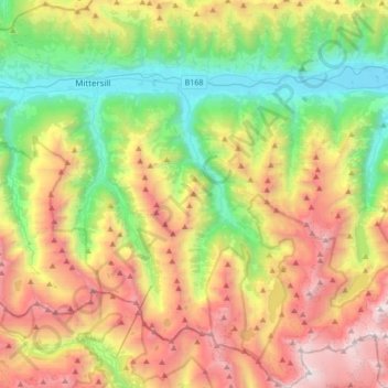
Name: Uttendorf topographic map, elevation, terrain.
Location: Uttendorf, Bezirk Zell am See, Salzburg, 5723, Austria (47.09952 12.52374 47.33063 12.68750)
Average elevation: 5,971 ft
Minimum elevation: 2,474 ft
Maximum elevation: 11,270 ft
Thank you for supporting this site ❤️
Make a donation
Make a donation
Gear up for your next adventure:
As an Amazon Associate, this site earns from qualifying purchases at no extra cost to you.