
Thank you for supporting this site ❤️
Make a donation
Make a donation
Gear up for your next adventure:
As an Amazon Associate, this site earns from qualifying purchases at no extra cost to you.
Antroli(001) topographic map
Click on the map to display elevation.
Thank you for supporting this site ❤️
Make a donation
Make a donation
Gear up for your next adventure:
As an Amazon Associate, this site earns from qualifying purchases at no extra cost to you.
About this map
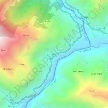
Name: Antroli(001) topographic map, elevation, terrain.
Location: Antroli(001), Nerua, Shimla, Himachal Pradesh, India (30.80214 77.72613 30.84214 77.76613)
Average elevation: 4,147 ft
Minimum elevation: 2,474 ft
Maximum elevation: 7,484 ft
Thank you for supporting this site ❤️
Make a donation
Make a donation
Gear up for your next adventure:
As an Amazon Associate, this site earns from qualifying purchases at no extra cost to you.