
Villamonte topographic map
Click on the map to display elevation.
About this map
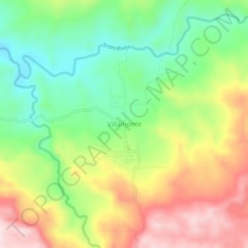
Name: Villamonte topographic map, elevation, terrain.
Location: Villamonte, Sultan Kudarat, Philippines (6.70385 124.22666 6.74385 124.26666)
Average elevation: 1,145 ft
Minimum elevation: 659 ft
Maximum elevation: 1,762 ft
Other topographic maps
Click on a map to view its topography, its elevation and its terrain.